Introduction to topographic contours
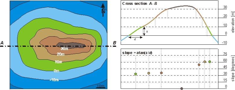
Topographic contours connect points of equal height on the Earth's surface above a given datum level, typically 'sea level'. Topographic contours are often subparallel to each other and their horizontal distance projected (vertically) onto a map is a function of the slope (gradient) of the surface. A map of an island, a cross-section (i.e. a vertical slice) along line A - B and a graph illustrating the slope of the surface are shown in the diagrams below.
|
NEXT
BACK
|