Introduction to outcrop patterns
After defining topographic and structure contours we can now intersect these two contours in order to obtain the outcrop pattern.
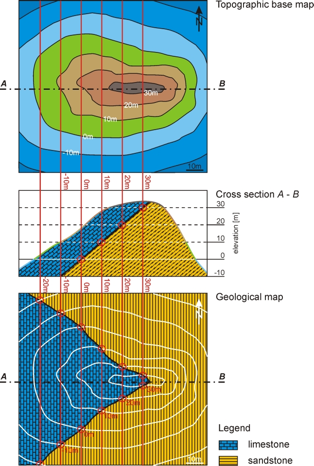
We revisit our island (topographic maps) and define the geology in cross-section (see diagram below).
The island is comprised of two formations (limestone and sandstone), which are dipping 40 degrees towards the west (strike of bedding
is N-S). Using the construction shown below (structure contours are labelled red lines) we can obtain the geological map.
|
NEXT
BACK
|